Horus uses high-resolution FLIR cameras to enable cost-effective automated road inspection at highway speeds. Mike Lee, Senior Product Manager at FLIR IIS, explains how mobile mapping solutions are utilised.
Today, it’s almost second nature to plug an address into a street mapping app to view panoramic photos of what a location looks like before you go there. Whether it’s to explore a vacation spot, view real estate property you might be interested in, or see if a new restaurant has ample parking, it’s a great way to get the lay of the land before going to your destination.
But this technology is even more valuable for industrial applications. Prior to intelligent mobile mapping solutions, public works departments sent employees in vehicles and on foot to visually inspect conditions before dispatching crews for repairs and maintenance on municipal roads, bridges, buildings, and highways.
A safer, effective, and more cost-efficient method is to perform this inspection digitally based on high-resolution image capture. With image-based mobile mapping, local governments can keep their streets and other infrastructure safe while saving time and money.
Video-Based Mobile Mapping
Horus, a systems integrator headquartered in the Netherlands, has disrupted the mobile mapping industry by using imagery data instead of conventional lidar surveying technology for mobile mapping in order to gain more detailed visual images of the assets being inspected. The company sells its mobile mapping systems to service providers who work with cities, towns, and utility companies to help them more effectively inspect, repair, and perform preventative maintenance on infrastructure.
Horus started as a mobile mapping service provider itself more than a decade ago and has since evolved into a software solutions company for the mobile mapping industry. Horus’ mission is to advance technologies and push boundaries to create visionary imaging solutions with the aim to make the world a better and safer place to live and work.
There is a revolution going on within the mobile mapping industry. The originally conservative mobile mapping market is catching up to take maximum advantage of scaling GPU power, advancements in artificial intelligence (AI), and high-end camera systems.
Today, the industry accommodates improved methods of traditional processes, especially now that AI and complex machine learning algorithms are proving to be effective in the field of mobile mapping. Horus’ hardware and software solutions allow them to deliver efficient, automated workflows to get decisive geographic information systems (GIS) data out of street-level imagery. Together with hardware manufacturers, mobile mapping system integrators, and AI, they have developed advanced intelligent video analytics solutions.
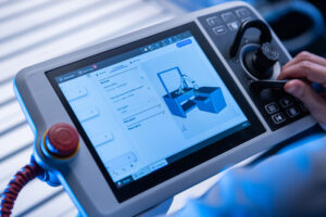
Horus’ CityMapper is a modular mobile mapping system that enables fast and productive capture of road, infrastructure, and city environmental data from a vehicle-mounted device. CityMapper is a turnkey solution that can be mounted on a car, boat, train, or other vehicle. Equipped with the Teledyne FLIR IIS (Integrated Imaging Solutions) Ladybug6 professional 360-degree camera and an Applanix global navigation satellite system/inertial navigation system (GNSS/INS) positional system, CityMapper captures street-level imagery with unprecedented speed, vastly reducing project operating costs and improving safety. The system delivers outstanding geo-referenced immersive panoramic images for road inspections and asset management applications. Automated road inspection can be done 10x faster with AI and the Horus GeoSuite mapping software.

Applications of Video-based Mobile Mapping
Novotecni is a consulting and engineering firm based in Spain.
“In the past, when we were starting out in the business, we developed our equipment setup in-house utilizing separate GPS, antennas, inertial measurement units, and the Teledyne FLIR IIS Ladybug5,” Eduardo Javier Serra explains. “Prior to commencing field operations on a daily basis, a team of two individuals would take anywhere between 45 to 90 minutes to install and initiate the system.”
He continues, “However, at present, with the aid of CityMapper and the Ladybug5+, our team is able to arrive on-site and complete the setup process within 15 to 20 minutes, increasing the amount of time available for capturing images and obtaining results. Consequently, this has led to an increase in the number of kilometers of coverage per day, resulting in fewer days required to finish projects, leading to substantial cost savings, while simultaneously requiring less fuel, thereby reducing our environmental impact.”

US-based Mastermind, a data collection software and services company, recognized the need to upgrade their existing Mapster system with a higher resolution spherical camera. They chose Horus because their customers expect to be able to zoom in on assets, view them up close, and read detailed information.
They commented, “Our experience with the Teledyne FLIR IIS LadyBug6 camera has been exceptional. Following the cameras’ arrival, and the steady support of Horus during integration, we were up and running in days. The panorama images are beautiful within the Horus GeoSuite mapping software, and the LadyBug6 has proved to be the comprehensive turnkey camera perfectly suited for our mobile mapping services.”
Written by Mike Lee, Senior Product Manager at FLIR IIS.
Check out part two here, as Mike Lee explains how the Horus’ Street-Level Imaging System works.